
78-Day Arctic To Andes: Greenland, Ic
Seabourn · Seabourn Pursuit
Depart
Aug 23, 2028
Return
Nov 9, 2028
Port
Reykjavik, Iceland
Nights
78 nights
At a glance
- Built
- 2023
- Tonnage
- 23000
- Cabins
- 132
- Crew
- 120
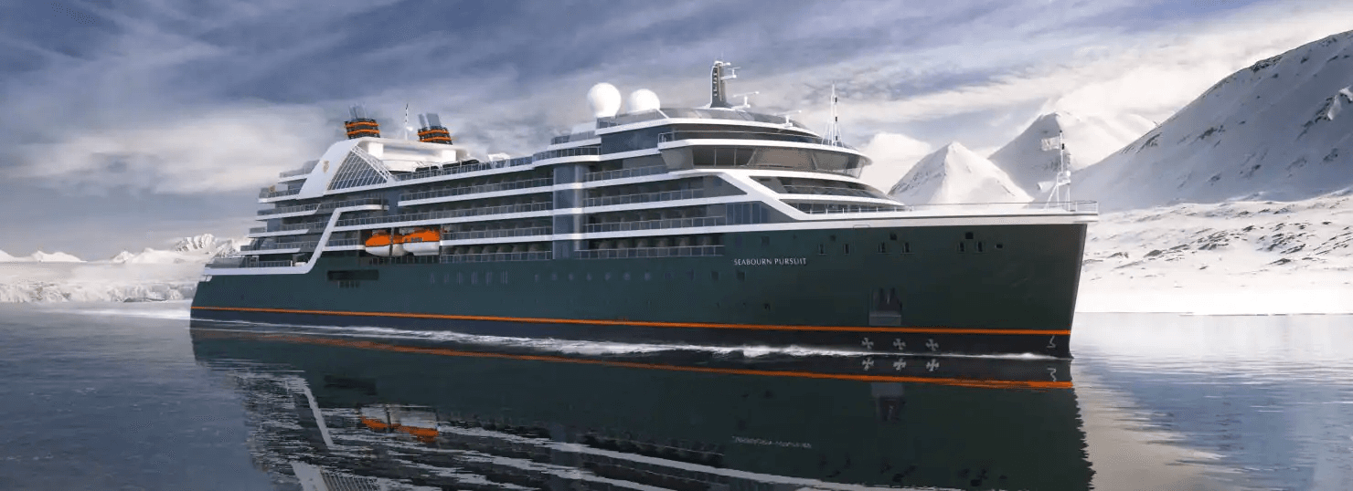
Construction for Seabourn Pursuit began in fall 2020 during a ceremony in San Giorgo di Nogare, Italy, and the build process is well underway. The ship is scheduled for delivery in 2023, with its sister ship, Seabourn Venture, slated for delivery in 2022. Seabourn Pursuit is the second Seabourn expedition ship slated to launch in 2023.
Ask our cruise specialists about cruise line loyalty benefits, status match options, drinks packages, gratuities and any current offers available on this sailing.
On board

Bowlounge

Colonnade
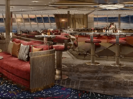
Constellationlounge

Discoverycenter

Expeditionlounge

Landing
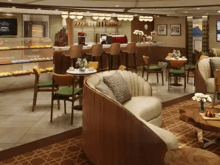
Pursuit square
Itinerary
Cruise from Reykjavik, Iceland to Ushuaia, Argentina
Day 1Cruise departs from Reykjavik, IcelandAug 22, 2028
Warmed by the Gulf Stream as well as by highly active thermal hot springs and volcanoes, Iceland is somewhat misnamed. While it is a stark and barren country with three huge areas of glaciers, one theory is that early Norsemen sought to mislead other potential settlers by giving a pleasant name to fierce, inhospitable Greenland, and a forbidding name to the imminently habitable Iceland. Irish monks and hermits established themselves here in the 8th century, but left a century later when the pagan Norsemen arrived. Europe's first Parliament of General Assembly, the Althing, was established in the year 930 and still functions as the legislative body, although it was suspended by the Danes at the end of the 18th century and not reconvened until 1843. Reykjavik was the site picked by the island's first permanent resident, Ingolfur Arnarson in 874, and is home to more than half of the island's total population. The world's northernmost capital, Reykjavik is proud of its virtual lack of air…
Day 1Reykjavik, IcelandAug 22, 2028 • Departs at: 5 pm
Warmed by the Gulf Stream as well as by highly active thermal hot springs and volcanoes, Iceland is somewhat misnamed. While it is a stark and barren country with three huge areas of glaciers, one theory is that early Norsemen sought to mislead other potential settlers by giving a pleasant name to fierce, inhospitable Greenland, and a forbidding name to the imminently habitable Iceland. Irish monks and hermits established themselves here in the 8th century, but left a century later when the pagan Norsemen arrived. Europe's first Parliament of General Assembly, the Althing, was established in the year 930 and still functions as the legislative body, although it was suspended by the Danes at the end of the 18th century and not reconvened until 1843. Reykjavik was the site picked by the island's first permanent resident, Ingolfur Arnarson in 874, and is home to more than half of the island's total population. The world's northernmost capital, Reykjavik is proud of its virtual lack of air…
Day 2Grundarfjordur, IcelandAug 24, 2028 • Arrives at: 7 am • Departs at: 5 pm
The charming small fishing village of Grundarfjörður is located in the middle of the Snæfellsnes Peninsula and thus provides easy access to Stykkishólmur, Snæfellsbær and the Snæfellsnes National Park. Its best-known landmark is undoubtedly the peak of Mt. Kirkjufell. Translated as ‘church mountain,’ Kirkjufell is the most easily recognizable peak, and one of the most photographed mountains in Iceland. During summer months a Viking Village is built in the center of town where Viking re-enactments occur quite regularly. During the Á góðri stund town festival in July, the town’s 900 residents decorate their houses in red, blue, yellow, and green, transforming the town into a spinning kaleidoscope of color. The town first began trade in 1786, and around 1800, French merchants came to Iceland and settled in Grundarfjörður, where they constructed a church and a hospital. The town has prospered through the fishing industry for a long time. The surrounding sea is rich with birdlife & marine…
Day 3Patreksfjordur, IcelandAug 25, 2028 • Arrives at: 6 am • Departs at: 2 pm
Day 3Dynjandi, IcelandAug 25, 2028 • Arrives at: 5 pm • Departs at: 9 pm
Day 4At SeaAug 26, 2028
Day 5Ittoqqortoormiit, GreenlandAug 27, 2028 • Arrives at: 8 am • Departs at: 6 pm
Day 6Exploring ScoresbysundAug 28, 2028 • Arrives at: 7 am • Departs at: 5 pm
Day 7Northeast Greenland National ParkAug 29, 2028 • Arrives at: 1 pm • Departs at: 5 pm
Day 8Northeast Greenland National ParkAug 30, 2028 • Arrives at: 7 am • Departs at: 5 pm
Day 9Northeast Greenland National ParkAug 31, 2028 • Arrives at: 7 am • Departs at: 5 pm
Day 10Northeast Greenland National ParkSep 1, 2028 • Arrives at: 7 am • Departs at: 5 pm
Day 11At SeaSep 2, 2028
Day 12Siglufjordur, IcelandSep 3, 2028 • Arrives at: 7 am • Departs at: 4 pm
Siglufjörður is the northernmost town on the Icelandic mainland, a small fishing village of some 1,200 people. Founded in 1918, it was in the past the capital of the North Atlantic herring fishing industry. The Síldarminjasafnið Herring Era Museum, one of Iceland's largest seafaring and industrial museums, houses three different areas where one can learn about both the traditional and the modern herring industry. A collection of many historic fishing vessels and artifacts is proudly displayed by the people of Siglufjörður, detailing how herring was salted, processed and collected. The small harbor with its colorful fishing boats and the red-roofed steeple of the Lutheran church dominate the village-scape. The natural beauty of the area includes high mountains that rim the fjord, freshwater lakes, the Hólsá river, black sand beaches, and a wealth of birdlife all around. This northernmost region of Iceland is renowned for some of the largest and most dramatic waterfalls in the country.
Day 13Flatey Island, IcelandSep 4, 2028 • Arrives at: 11 am • Departs at: 5 pm
Day 14Exploring The Outer Islands of HeimaeySep 5, 2028 • Arrives at: 7 am • Departs at: 11 am
Day 14Heimaey, Westman Islands, IcelandSep 5, 2028 • Arrives at: 12 pm • Departs at: 7:30 pm
Day 15Reykjavik, IcelandSep 6, 2028 • Arrives at: 7 am • Departs at: 5 pm
Warmed by the Gulf Stream as well as by highly active thermal hot springs and volcanoes, Iceland is somewhat misnamed. While it is a stark and barren country with three huge areas of glaciers, one theory is that early Norsemen sought to mislead other potential settlers by giving a pleasant name to fierce, inhospitable Greenland, and a forbidding name to the imminently habitable Iceland. Irish monks and hermits established themselves here in the 8th century, but left a century later when the pagan Norsemen arrived. Europe's first Parliament of General Assembly, the Althing, was established in the year 930 and still functions as the legislative body, although it was suspended by the Danes at the end of the 18th century and not reconvened until 1843. Reykjavik was the site picked by the island's first permanent resident, Ingolfur Arnarson in 874, and is home to more than half of the island's total population. The world's northernmost capital, Reykjavik is proud of its virtual lack of air…
Day 16Exploring The Outer Islands of HeimaeySep 7, 2028 • Arrives at: 7 am • Departs at: 11 am
Day 16Heimaey, Westman Islands, IcelandSep 7, 2028 • Arrives at: 12 pm • Departs at: 7 pm
Day 17At SeaSep 8, 2028
Day 18Prins Christian Sund, GreenlandSep 9, 2028 • Arrives at: 4 pm
Day 19Prins Christian Sund, GreenlandSep 10, 2028 • Departs at: 12 pm
Day 19Kangikitsok, GreenlandSep 10, 2028 • Arrives at: 3 pm • Departs at: 8 pm
Day 20Qaqortoq, GreenlandSep 11, 2028 • Arrives at: 8 am • Departs at: 2 pm
The largest town in South Greenland with over 3,500 citizens, Qaqortoq was founded in 1775 and still reveals some examples of colonial-period architecture. There is not infrastructure to support shore excursions here, but guests can explore the town and its museum, or possibly arrange a visit to a nearby hot springs. Like other towns in Greenland, there are also possibilities to buy examples of traditional Inuit arts and crafts, including items crafted of bone, soapstone and wild-harvested furs.
Day 20HvalseySep 11, 2028 • Arrives at: 3 pm • Departs at: 8 pm
Twelve miles by Zodiac up the Hvalseyjarfjord from Qaqortoq, the largest community in South Greenland, lies the most prominent Norse archaeological site in Greenland. The so-called Eastern Settlement lasted from the 10th until the mid-15th century. Your expedition team archaeologist can interpret for you the ruins of the great halls and church at Hvalsey that hint of a prospering medieval farmstead. The site evokes an era when the Norse were trading with the indigenous Thule people of the area for furs and ivory, which were a prized commodities in Europe. A wedding held in the church in 1408 comprises the last written record of the Norse adventure in Greenland. Within a few years, Hvalsey and the rest of other Norse communities of Greenland withered as immigrants returned to the more established communities in Iceland and Norway. The site’s meadows of wildflowers sloping up from the fjord give a sense of the peaceful community that existed here in that long-ago summer.
Day 21Brattahlid (Qassiarsuk), GreenlandSep 12, 2028 • Arrives at: 7 am • Departs at: 12 pm
Day 22At SeaSep 13, 2028
Day 23Nain, Labrador, CanadaSep 14, 2028 • Arrives at: 7 am • Departs at: 4 pm
Day 24Nachvak Fiord, Torngat Mts, CanadaSep 15, 2028 • Arrives at: 9 am • Departs at: 5 pm
Day 25Eclipse Channel, Labrador, CanadaSep 16, 2028 • Arrives at: 7 am • Departs at: 5 pm
Day 26Saglek Fjord, Labrador, CanadaSep 17, 2028 • Arrives at: 7 am • Departs at: 5 pm
Day 27Hopedale, Labrador, CanadaSep 18, 2028 • Arrives at: 10 am • Departs at: 7 pm
Day 28Indian Harbour, NL, CanadaSep 19, 2028 • Arrives at: 7 am • Departs at: 5 pm
Day 29L Anse aux Meadows, Newfoundland, CanadaSep 20, 2028 • Arrives at: 8 am • Departs at: 6 pm
Located at the most northerly tip of Newfoundland, L'Anse aux Meadows is nestled near the fishing village of St. Anthony. It is the site of the first European settlement in the New World, approximately 500 years before Columbus' arrival. Other Norse groups had relocated from their homelands to the New World. In 1961, explorer and writer Helge Instad discovered a group of large mounds in the countryside. These mounds were excavated revealing the remains of a Norse settlement. This site became L'Anse aux Meadows National Historic Park in 1977 and is noted on the UNESCO World Heritage List of important cultural properties. The site at L'Anse aux Meadows has been completely excavated allowing visitors to see the remains of the homes, a smithy, and various worksheds. The park's interpretive center displays Norse artifacts from the excavation which include iron rivets, a flywheel and the floorboard of a boat. Researchers still debate as to whether the site at L'Anse aux Meadows is Leif Erik…
Day 30Red Bay, Labrador, CanadaSep 21, 2028 • Arrives at: 7 am • Departs at: 5 pm
Red Bay is a National Historic Site of Canada, and has been nominated by Canada for inclusion as a UNESCO World Heritage Site. One of the reasons is the importance of the Basque whaling activity that thrived here in the 16th and early 17th centuries. Sunken Basque galleons and smaller boats from the period have been discovered just offshore. Although the whale population is much diminished today, it is still a popular activity to watch them, as well as the icebergs that float down from the seas further north.
Day 31Norris Point, Newfoundland, CanadaSep 22, 2028 • Arrives at: 7 am • Departs at: 5 pm
Day 32At SeaSep 23, 2028
Day 33Halifax, Nova ScotiaSep 24, 2028 • Arrives at: 7 am • Departs at: 5 pm
With its exceptionally delightful harbor side setting, early Europeans were first attracted to Halifax in 1749 with the establishment here of a military outpost by Colonel Cornwallis. The ports natural advantages of a well-protected harbor and close proximity to major fishing grounds resulted in its growth into a major military base and sea port. The peninsula has had several major immigrations during its history; English, French, German, Irish and Scottish have come in substantial numbers at various times. Travelers familiar with the South Pacific will find it interesting to know that Captain James Cook, whose explorations defined most of the Pacific Basin for Europeans, also spent four years in Halifax charting Nova Scotia and the waters of the St. Lawrence. A college town, Halifax has an exhilarating and youthful air about it, as evidenced by many bicyclists and skateboarders. The heart of Halifax offers wonderful restaurants and shopping, galleries, museums, and sites of historic…
Day 34At SeaSep 25, 2028
Day 35At SeaSep 26, 2028
Day 36Hamilton, BermudaSep 27, 2028 • Arrives at: 8 am • Departs at: 5 pm
Of the 300 coral atolls which comprise the British crown colony of Bermuda, only 20 are inhabited. Extremely treacherous coral reefs surround the area, as indicated by the 300 shipwrecks lying offshore. Self-governed in internal affairs since 1968, Bermuda remains under the protective umbrella of Great Britain for defense and external affairs. Hamilton, in particular, is decidedly British in atmosphere and tradition. Dazzling beaches, beds of Bermuda lilies, almost luminescent bougainvillea vines and clusters of oleander provide a most inviting backdrop for the island's luxury hotels, elegant boutiques and fine restaurants. Daytime activities abound, while exciting entertainment beckons you ashore in the evening. Welcome to Bermuda.
Day 37At SeaSep 28, 2028
Day 38At SeaSep 29, 2028
Day 39San Juan, Puerto RicoSep 30, 2028 • Arrives at: 7 am • Departs at: 5 pm
Puerto Rico has been voluntarily associated with the United States since it was ceded by Spain in 1898. In 1952, this island country became a self-governing commonwealth territory of the United States. The capital, San Juan, is a teeming city of over 1.5 million. Remnants of colonial architecture stand side by side with the most modern high rises in this city of contrasts. The 7-square-block area, which contains the historic zone of Old San Juan, was once completely encircled by city walls and is still guarded by the impressive forts of El Morro and San Cristobal, which loom over the harbor as reminders of the centuries of Spanish rule. El Yunque rainforest, on the northeastern side of the island, is just one of many distinctive geographical features found here. Mountain lakes, waterfalls, teak forests, and three magnificent phosphorescent bays offer the visitor a variety of diversions.
Day 40At SeaOct 1, 2028
Day 41Oranjestad, ArubaOct 2, 2028 • Arrives at: 7 am • Departs at: 11 pm
Although no written record of the island's discovery by Europeans exists, it was in 1499 that Alonso de Ojeda landed in Aruba and claimed the island for Spain. Over the years, possession changed from the Spanish to the Dutch to the British and back to the Dutch, with independence promised by 1996. Aruba is one of only a few Caribbean islands where the indigenous Indian population was not decimated by invading Europeans. The native Aruban today is a mixture of Arawak Indian, and Spanish and Dutch colonizers. The official language is Dutch, with both English and Spanish widely spoken. The local population's everyday tongue is Papiamento, a mixture of all of the above plus a few words left over from the days of the Arawak. The countryside is dotted with cottages surrounded by cactus fences and bright splashes of bougainvillea, oleander and hibiscus. During our call, enjoy a stroll through the capital, Oranjestad. Colorful Wilhelminastraat is lined with typical Aruban buildings of the Dut…
Day 42At SeaOct 3, 2028
Day 43At SeaOct 4, 2028
Day 44Panama Canal CruisingOct 5, 2028 • Arrives at: 6 am • Departs at: 8 pm
Day 44Fuerte Amador (Panama City), PanamaOct 5, 2028 • Arrives at: 9 pm
Formerly a fortified armory, this newly developed port is the portal to colonial Panama City and an in-depth look at Miraflores Locks. Also from here, you can visit an Embera Indian village.
Day 45Fuerte Amador (Panama City), PanamaOct 6, 2028 • Departs at: 4 pm
Formerly a fortified armory, this newly developed port is the portal to colonial Panama City and an in-depth look at Miraflores Locks. Also from here, you can visit an Embera Indian village.
Day 46At SeaOct 7, 2028
Day 47At SeaOct 8, 2028
Day 48Guayaquil (Quito), EcuadorOct 9, 2028 • Arrives at: 5 am • Departs at: 6 pm
Perched on the banks of the Guayas River, Guayaquil is the country's principal seaport and economic center. Cargo ships, ferry boats and dugout canoes compete for space on the busy waterfront where sailing ships once departed for Europe with stores of gold and silver.
Day 49At SeaOct 10, 2028
Day 50At SeaOct 11, 2028
Day 51Callao (Lima), PeruOct 12, 2028 • Arrives at: 5 am
A 45-minute drive from the port city of Callao brings you to exciting Lima, the City of Kings. From its founding in 1535 until today, it remains one of the most important cities in all South America. The handsome old buildings from the earliest colonial days surrounding the Plaza de Armas contrast with the soaring modern towers rising in the newer sections of the city.
Day 52Callao (Lima), PeruOct 13, 2028 • Departs at: 9 pm
A 45-minute drive from the port city of Callao brings you to exciting Lima, the City of Kings. From its founding in 1535 until today, it remains one of the most important cities in all South America. The handsome old buildings from the earliest colonial days surrounding the Plaza de Armas contrast with the soaring modern towers rising in the newer sections of the city.
Day 53General San Martin (Pisco), PeruOct 14, 2028 • Arrives at: 8 am • Departs at: 7 pm
Pisco dates from 1640, and its Plaza de Armas is a Spanish colonial treasure. Another treasure is the Ballestas Islands, an offshore cluster of rocky outcroppings teeming with seabirds, penguins, sea lions, dolphins and other wildlife. Many visitors take the opportunity to take a scenic flight over the huge, mysterious Nazca Lines pictographs etched into the nearby desert surface 2,000 years ago. And still more belly up to a bar to sample a Pisco Sour cocktail made with the Pisco brandy distilled from locally grown grapes.
Day 54At SeaOct 15, 2028
Day 55At SeaOct 16, 2028
Day 56At SeaOct 17, 2028
Day 57Valparaiso (Santiago), ChileOct 18, 2028 • Arrives at: 8 am • Departs at: 5 pm
Picturesque Valparaiso was one of the first Chilean cities founded by the Spanish. The city is an historic port and university town, famous for its labyrinth hills, which are covered in quaint, colorful old houses and accessible only by a steep climb or by the city's unique system of funicular railways. Through the efforts of the Chilean government emphasizing the city's culture, heritage preservation, and economic development via tourism, Valparaiso was bestowed designation as a World Heritage Site by UNESCO in 2003.
Day 58At SeaOct 19, 2028
Day 59The Seabourn Juan Fernandez ExperienceOct 20, 2028 • Arrives at: 7 am • Departs at: 5 pm
Day 60The Seabourn Juan Fernandez ExperienceOct 21, 2028 • Arrives at: 7 am • Departs at: 5 pm
Day 61The Seabourn Juan Fernandez ExperienceOct 22, 2028 • Arrives at: 7 am • Departs at: 12 pm
Day 62At SeaOct 23, 2028
Day 63Scenic Cruising Reloncavi SoundOct 24, 2028
Puerto Montt, in Chile’s Northern Patagonia Los Lagos region is set on the shores of a large bay identified as Reloncavi Sound. To the east looms Mt. Yate, a snowcapped, glaciated stratovolcano, and beyond that the cordillera of the Andes. The sound is punctuated by islands, the three largest being Tengio, Maillén and Huar. Two much larger islands, Puluqiui and Queulín, sprawl across the mouth of the sound, separating it from the Gulf of Ancud. The point where the Reloncavi Estuary empties into the sound is effectively where the Chilean Central Valley meets the Pacific Ocean. Salmon farms dimple the coves of the sound, and pods of orcas are sometimes seen. Near the sound on shore, Chile’s Alerce Andino National Park protects a vestigial forest of ancient alerce trees, similar to the huge sequoias found in North America.
Day 63Puerto Montt, ChileOct 24, 2028 • Arrives at: 8 am • Departs at: 6 pm
The lake country of southern Chile seems to be altogether another world from the deserts of the north. The Lake District is graced with spectacular scenery, including the magnificent snowcapped volcanic cone, Mt. Osorno. Puerto Montt serves as the principal port for this region and as a gateway for cruises southward into Chile's fjords.
Day 64Scenic Cruising Moraleda ChannelOct 25, 2028
The Moraleda Channel is a protected waterway running along the coast of Chile from the Gulf of Corcovado in the north to the Laguna San Rafael in the south. It separates the myriad mountainous islands of the Chonos Archipelago from the Chilean mainland. Like the Inside Passage on the Pacific coast of North America, the Moraleda Channel is a geological feature. Its course follows the geologic Liguiñe-Ofqui Fault on the eastern side of the islands, which are actually the peaks of the submerged Chilean Coastal Range.
Day 64Scenic Cruising Darwin ChannelOct 25, 2028
The Darwin Channel cuts through the elongated, mountainous islands of the Chonos Archipelago in Southern Chile, connecting the Pacific Ocean on the west with the Moraleda Channel running along the Chilean mainland. These forested islands, mostly uninhabited, are actually the peaks of the submerged Chilean Coastal Range. Darwin Channel is a westward continuation of the Aysén Fjord, connecting to the Pacific at Isquiliac Island, and opening at its eastern end into Darwin Bay. Being free of navigational hazards, it forms a preferred, scenic pathway for ships navigating in the area.
Day 65Scenic Cruising Baker ChannelOct 26, 2028
The Baker Channel is a large, multi-armed fjord that cuts from Tarn Bay in the Gulf of Penas some 75 miles into the Chilean mainland. It lies roughly halfway between the Northern and Southern Patagonian Ice Fields, and its southern arm culminates at the face of the Jorge Montt Glacier, which flows from the Southern ice field and frequently calves icebergs into the channel. The channel forms the northern boundary of Chile’s vast Bernardo O’Higgins National Park.
Day 65Transit The English NarrowsOct 26, 2028
On the long Messier Channel between the huge Wellington island and the Chilean mainland, the English Narrows is a natural, eight-mile obstacle consisting of a scattering of islands constricting the passage to a width of as little as 200 yards. It presents no hazard to a skilled navigator under most conditions, but at spring tides the current runs as much as six knots, and wind conditions may also make navigation risky. The narrows transit is a good time to be on deck, to keep an eye out for birds such as diving petrels or steamer ducks, and possibly the small, rare dolphins that are sometimes seen in remote areas like this.
Day 65Caleta Tortel, ChileOct 26, 2028 • Arrives at: 10 am • Departs at: 6 pm
Day 66Scenic Cruising Eyre FjordOct 27, 2028
Eyre Fjord penetrates the mainland of southern Chile from the Icy Channel about 20 miles to the broad face of the massive Pio XI glacier, also known as the Brüggen Glacier. It is the longest glacier in the Southern Hemisphere outside Antarctica, flowing some 40 miles from the Southern Patagonian Ice Field to the fjord. It is also one of the very few advancing glaciers on earth. The glacier face is located near a large eastern arm of Eyre Fjord called Exmouth Fjord.
Day 66Scenic Cruising Wide ChannelOct 27, 2028
The Wide Channel is an inside passage along the coast of southern Chile. It separates the eastern lobe of the huge Wellington Island from the Chilean mainland, starting between Saumarez Island and Icy Channel in the north and opening into the Concepcion Channel in the south adjacent to the Bernardo O’Higgins National Park on the mainland Wilcock Peninsula. Surrounded by precipitous mountains, its shoreline on the mainland side is interrupted by two large fjords, the Europa and Penguin fjords. Join your expedition team members on deck or in an observation lounge for expert insights into the area.
Day 66Pio XI GlacierOct 27, 2028 • Arrives at: 8 am • Departs at: 1 pm
Day 67Scenic Cruising Peel FjordOct 28, 2028
Cutting eastward from the Sarmiento Channel in Southern Chile, this fjord divides into three separate fjords, called Amalia, Asia and Calvo Fjords. Amalia leads to Amalia Glacier, the El Brujo Glacier is in Asia Fjord, and Calvo boasts several small glaciers of its own. The mainland to the east is all part of the huge Torres del Paine National Park. The area is a fascinating geological panorama, and your expedition team members will be available to interpret the sights, as well as identify wildlife spotted while cruising the scenic waterways.
Day 67Scenic Cruising Smyth ChannelOct 28, 2028
The Smyth Channel is another of the spectacular waterways threading the maze of islands off the coast of extreme southern Chile. At its northern end, it briefly parallels the Sarmiento Channel, then veers southward opening into the Strait of Magellan. Dotted with myriad small islands and corrugated with countless narrow fjords and bays, it makes a mesmerizing panorama as your ship plies between the islands on one side and the immense Peninsula Muñoz-Gamero on the other. Members of your expedition team will be on deck and in lounges to offer insights into the wild, unspoiled terrain you are passing.
Day 67Brujo GlacierOct 28, 2028 • Arrives at: 7 am • Departs at: 11 am
Day 68Strait of MagellanOct 29, 2028
The Strait of Magellan is a 350-mile/570 km channel separating the mainland of South America from the large Isla Grande de Tierra del Fuego and connecting the Atlantic and Pacific Oceans. It was first navigated by the explorer Ferdinand Magellan during his circumnavigation voyage in 1520. He named it the Strait of All Saints, because his transit started on November 1, All Saints Day. It was also Magellan who name the southern island Tierra del Fuego, after seeing the smokes from fires in the camps of the native Yahgan people, whom he named the Patagones, meaning “big feet,” and their land Patagonia. The strait is between two and 20 miles wide, and earned the nickname Dragon’s Tail among sailors, for its tortuous path. Along with the Beagle Channel, it was one of two protected channels for sailing between the oceans prior to the construction of the Panama Canal The third alternative was the notoriously turbulent open ocean Drake Passage beyond Cape Horn. There is one sizeable port city…
Day 68Punta Arenas, ChileOct 29, 2028 • Arrives at: 12 pm
Red roofs and smoking chimneys decorate the gently sloping hillsides of Punta Arenas (Sandy Point), the bustling center of one of the world's largest sheep farming areas. This pleasant community welcomes you with attractive parks and delightful Victorian architecture.
Day 69Punta Arenas, ChileOct 30, 2028 • Departs at: 6 pm
Red roofs and smoking chimneys decorate the gently sloping hillsides of Punta Arenas (Sandy Point), the bustling center of one of the world's largest sheep farming areas. This pleasant community welcomes you with attractive parks and delightful Victorian architecture.
Day 70At SeaOct 31, 2028
Day 71At SeaNov 1, 2028
Day 72The Seabourn Antarctic ExperienceNov 2, 2028 • Arrives at: 7 am • Departs at: 5 pm
Day 73The Seabourn Antarctic ExperienceNov 3, 2028 • Arrives at: 7 am • Departs at: 5 pm
Day 74The Seabourn Antarctic ExperienceNov 4, 2028 • Arrives at: 7 am • Departs at: 5 pm
Day 75The Seabourn Antarctic ExperienceNov 5, 2028 • Arrives at: 7 am • Departs at: 5 pm
Day 76The Seabourn Antarctic ExperienceNov 6, 2028 • Arrives at: 7 am • Departs at: 5 pm
Day 77At SeaNov 7, 2028
Day 78Ushuaia, ArgentinaNov 8, 2028 • Arrives at: 7 pm
The southernmost city in the world, Ushuaia is the capital of Argentine Tierra del Fuego and an important naval base boasting a strategic as well as a picturesque location on the shores of Ushuaia Bay and the Beagle Channel. This rustic coastal town is set among waterfalls, glaciers, snow-clad mountains and beech forests, and the nutrient-rich local waters abound with marine life. Though the houses here are painted warm, pastel colors, the weather is chilly year-round and winter sports such as downhill and cross-country skiing and skating are popular. Ushuaia's principal industries are raising sheep, logging, fishing and trapping. It became a boomtown with 30,000 residents in the late 1980's when the government sought to increase Argentina's presence near Antarctica by giving tax breaks to citizens who settled here.
Day 79Cruise returns to Ushuaia, ArgentinaNov 9, 2028 • Arrives at: 6 am
The southernmost city in the world, Ushuaia is the capital of Argentine Tierra del Fuego and an important naval base boasting a strategic as well as a picturesque location on the shores of Ushuaia Bay and the Beagle Channel. This rustic coastal town is set among waterfalls, glaciers, snow-clad mountains and beech forests, and the nutrient-rich local waters abound with marine life. Though the houses here are painted warm, pastel colors, the weather is chilly year-round and winter sports such as downhill and cross-country skiing and skating are popular. Ushuaia's principal industries are raising sheep, logging, fishing and trapping. It became a boomtown with 30,000 residents in the late 1980's when the government sought to increase Argentina's presence near Antarctica by giving tax breaks to citizens who settled here.
Cabin options
Compare the cabin types and onboard features shown for this sailing. Final price and availability are confirmed by our team when you inquire.
10 cabin grades listed for this sailing.
Next step
Cabin grades and prices
View every cabin grade and current availability on the next step.