
Lautoka to Kobe
Silversea · Silver Cloud
Depart
Apr 14, 2027
Return
May 16, 2027
Port
Lautoka
Nights
32 nights
At a glance
- Built
- 1993
- Tonnage
- 17400
- Cabins
- 126
- Crew
- 212
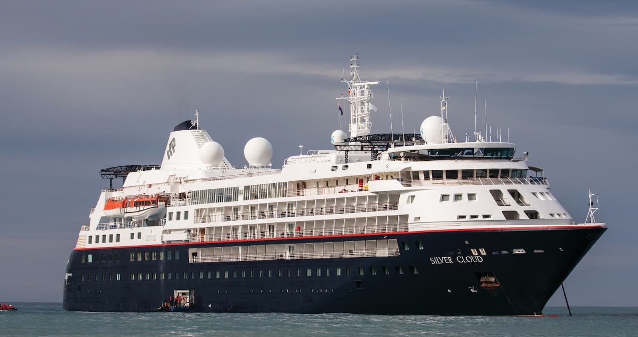
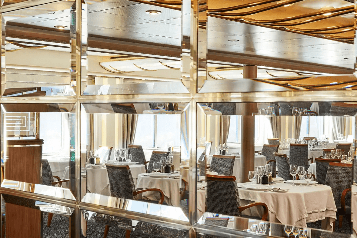
After extensive refurbishment, Silver Cloud is the most spacious and comfortable ice class vessel in expedition cruising. Her large suites, her destination itineraries and her unparalleled service make her truly special. Her four dining options will tantalise your taste buds and as 80% of her suites include a veranda, watching a breaching whale or a few cavorting penguins has never been so personal.
Ask our cruise specialists about cruise line loyalty benefits, status match options, drinks packages, gratuities and any current offers available on this sailing.
On board
Restaurant
Itinerary
Cruise from Lautoka to Kobe
Day 1Cruise departs from LautokaApr 14, 2027 • Departs at: 7 pm
Lautoka is often described as the sugar city. Sugar cane is the major industry of Fiji and Lautoka is its main base. Here are the industries' headquarters, the largest sugar mill, modern loading facilities and a large wharf. It features 70 miles of roads, almost all paved, a wonderful botanical garden and royal palm trees decorating the city's main street, Vitogo Parade. The municipal market is another attraction from both outside and inside. Fiji typifies the image of paradise. The people here live as they have done for centuries, retaining their ancient traditions and simple and carefree lifestyle supported by the harvest of a generous land and bountiful sea.
Day 2At SeaApr 15, 2027
Day 3Ambrym Island, VanuatuApr 16, 2027 • Arrives at: 12:30 pm • Departs at: 10:30 pm
Unlike Espiritu Santo with its raised coral reefs and white sand, Ambrym is a volcanically active island with dark sand beaches. Ambrym is known as the island of magic and is the source of five local languages that all evolved on Ambrym. This handful of languages contributes to the well over 100 languages of Vanuatu. Some of Ambrym’s magic takes place in the lush greenery of the local community of Ranon. Here the people perform a very special and traditional ‘Rom’ dance. Participants prepare their masks and costumes in secrecy and the dance is reserved for special occasions.
Day 4Pentecost IslandApr 17, 2027 • Arrives at: 6:30 am • Departs at: 6 pm
Pentecost Island is a lush mountainous, tropical island stretching over 37 miles from north to south. It was named after the day on which the first European, Louis Antoine de Bougainville, sighted it on 22 May 1768. There are no towns on Pentecost - most of the islanders live in small villages and grow their own food in small gardens. Local traditions are strong, including the age-old ritual of land diving. This unique ritual was first given international exposure by David Attenborough in 1960. View less Later, in the 1980s, New Zealander AJ Hackett used the idea to invent bungee jumping. Every harvest season from April to June, the people of southern Pentecost construct the towers around a lopped tree, using saplings and branches held together with forest vines. It can take up to five weeks to complete. Each young man who jumps must carefully select his own liana vine. Men and boys as young as seven jump from platforms at different heights (between30 and 90 feet) with only those vine…
Day 5At SeaApr 18, 2027
Day 6Santa Ana, Solomon IslandsApr 19, 2027 • Arrives at: 6 am • Departs at: 12:30 pm
Port Mary is the name of the bay adjacent to Ghupuna, the main village in Santa Ana. A bright white sand beach with huge shade-giving trees runs along the shoreline in front of the tidy village. The houses here are made with local materials and most are built on stilts. Islanders generally welcome visitors with traditional songs and dances performed by members of the three different villages on Santa Ana. Some local people will also set up stands offering souvenirs for purchase. View less The Solomons are best known for strings of traditional shell money and elegant carvings based on local stories and legends.
Day 7Lumalihe IslandApr 20, 2027 • Arrives at: 10 am • Departs at: 7 pm
Day 8At SeaApr 21, 2027
Day 9Rabaul, Papua New GuineaApr 22, 2027 • Arrives at: 7 am • Departs at: 11 pm
If surreal and unique experiences are your thing, then the Papua New Guinean town of Rabaul should tick your travel boxes. Found on the north eastern tip of New Britain Island (the largest island off mainland PNG) Rabaul, the former provincial capital, has quite a remarkable location. The town is inside the flooded caldera of a giant volcano and several sub-vents are still quite active today! The lively city was almost entirely devastated by Mount Tavurvur in 1994, covering the city in ashfall, but thankfully costing no lives. View less Since then, thanks to Rabaul’s deep-water port, commerce has been on the up, and a few shops and hotels have managed to find an audience. However, Rabaul’s remote location together with the volcano still being one of the most active and dangerous in Papua New Guinea means tourism in not rife. Rabaul has an impressive WWII history which includes a 300-mile network of tunnels dug by Japanese POW designed to conceal munitions and stores. After the Pearl H…
Day 10Garove Island, Papua New GuineaApr 23, 2027 • Arrives at: 12:30 pm • Departs at: 7 pm
The volcanic island of Garove is part of the Witu Islands and once had a 5-kilometer-wide (3.1 miles) caldera. The island was historically used to produce copra and cocoa, and in fact, still is today. Most of the villages are located around the exterior of the volcano. Steep cliffs explain why there is only one area settled on the inside. A promontory at the entrance’s southwestern corner is taken up by the school and the catholic church of the village of Widu, the only village inside the caldera.
Day 11At SeaApr 24, 2027
Day 12Kapingamarangi, MicronesiaApr 25, 2027 • Arrives at: 7:30 am • Departs at: 6 pm
Kapingamarangi is the most southerly atoll of the Caroline Islands and thereby also the most southerly of Pohnpei State. Closer to New Ireland, PNG than to Pohnpei, Kapingamarangi is one of the few Polynesian outliers in the western Pacific. The atoll and its lagoon cover an area of more than 70 square kilometers, but the combined land of the 33 islets on the lagoon’s eastern side is only 1.1 square kilometer. Three of these islets are home to the roughly 500 residents of Kapingamarangi. View less Touhou, the smallest of the three, has the largest population and is connected to larger Ueru (sometimes spelt Welua) by a zigzagging causeway. Just south of Touhou –and slightly bigger- is Taringa (Taarin) which has the smallest group of residents. In total there are some 500 people living on Kapingamarangi, but more live in the village of Porakiet on Pohnpei where they were given land by the former Japanese administration in 1919. The Greenwich Passage with its two narrow channels on the a…
Day 13Nukuoro , MicronesiaApr 26, 2027 • Arrives at: 7:30 am • Departs at: 6 pm
Nukuoro is Pohnpei’s second most southerly atoll some 480 kilometers southwest of the island of Pohnpei. The nearly circular atoll with a deep central lagoon has some 46 islets on the almost unbroken reef surrounding the 40 square kilometer lagoon. It is said that at low tide it was possible to walk from one islet to the other without getting wet. View less Some of these islets are not natural, but man-made by building up pieces of coral on the lagoon side of shallow reef areas as seawalls, having them filled with sand by the ocean and eventually bringing soil to use them for gardening. The combined landmass of all these islets is 1.7 square kilometers and the largest of these islets close to the channel into the lagoon, Nukuoro Island, is also the administrative center. This main islet has a village spread along the lagoon side with a population of roughly 400 residents, although several hundred Nukuorans live on Pohnpei, the main island of the state. While formerly Nukuoro’s inhabit…
Day 14At SeaApr 27, 2027
Day 15Kolonia, Pohnpei, MicronesiaApr 28, 2027 • Arrives at: 6:30 am • Departs at: 7 pm
Pohnpei (also known as Ponape) is the largest island in the Eastern Caroline Archipelago and the national capital of the Federated States of Micronesia (FSM). The State of Pohnpei is one of four that comprise the FSM, along with the islands of Chuuk, Kosrae and Yap. Unlike other Micronesian islands, volcanic Pohnpei boasts tropical jungles, mist-covered mountains, mangrove swamps and exotic flora. Abundant rainfall feeds streams, rivers and tumbling waterfalls.
Day 16At SeaApr 29, 2027
Day 17Chuuk Lagoon, MicronesiaApr 30, 2027 • Arrives at: 6:30 am • Departs at: 4 pm
Chuuk Lagoon, formerly known as Truk Lagoon, is the main island of Chuuk State –with more than 36,000 residents the largest of the four states making up the Federated States of Micronesia. Located at the center of the Caroline Islands, the reef protecting the lagoon has a length of more than 220 kilometers with 41 islets on it, while 57 islands and islets are found within the lagoon. The capital Weno is on Weno, one of the two larger of several other volcanic islands in the lagoon, hence the local name of Chuuk (mountain). Since none of the islands actually carries the name Chuuk, the lagoon and islands are commonly known as Chuuk Islands. Some 1600 years before the Spaniards first saw and then claimed Chuuk Lagoon, Micronesian had already established themselves on two of the islands. The Caroline Islands were sold to Germany in 1899 as a result of the Spanish-American War and later turned over to Japan as a mandated territory after WWI. The natural harbor created by the reef had been…
Day 18At SeaMay 1, 2027
Day 19ApraMay 2, 2027 • Arrives at: 9 am
Guam is blessed with spectacular natural beauty and a rich cultural history. Apra Harbor is a deep-water port located on the western side of the island. The island is part of the Mariana Islands and near the Mariana Trench, which is the deepest part of the earth’s oceans, and the deepest location of the earth itself. The port serves both as a U.S. naval station and Guam’s main commercial port. The harbour, formed by the Orote Peninsula to the south and Cabras Island in the north, is considered to be one of the best natural ports in the Pacific. Guam’s unique culture, traditions and heritage have remained intact despite European imperialism, wars and changing foreign governments. Archaeological evidence suggests that the indigenous Chamorros of Indo-Malayan descent migrated from the Southeast Asian islands and settled throughout the Marianas archipelago. Being expert seamen and skilled craftsmen, they flourished and built unique houses and canoes suited to the region. As a matriarchal…
Day 20Saipan, Northern Mariana IslandsMay 3, 2027 • Arrives at: 7 am • Departs at: 1:30 pm
Saipan is the largest of the Northern Mariana Islands, a U.S. commonwealth in the Western Pacific. It’s characterized by sandy shores and mountainous landscapes, and has several championship golf courses. Its highest point is 1,555-ft. Mt. Tapochau, a limestone peak at the island's center. Close to the northern tip, Japanese memorials mark Banzai Cliff and Suicide Cliff, sites from the 1944 Battle of Saipan.
Day 21Pagan, Northern Mariana IslandsMay 4, 2027 • Arrives at: 7 am • Departs at: 6 pm
Pagan is a volcanic island in the Marianas archipelago in the northwest Pacific Ocean, under the jurisdiction of the Commonwealth of the Northern Mariana Islands. It lies midway between Alamagan to the south, and Agrihan to the north
Day 22At SeaMay 5, 2027
Day 23At SeaMay 6, 2027
Day 24Torishima Island CruisingMay 7, 2027 • Arrives at: 1 pm • Departs at: 2 pm
Minami-Tori-shima also known as Marcus Island, is an isolated Japanese coral atoll in the northwestern Pacific Ocean, located some 1,848 kilometers (1,148 mi) .
Day 25ShimizuMay 8, 2027 • Arrives at: 11 am • Departs at: 11 pm
Feel your heart thumping, at your first sight of Japan’s most heavenly vision - Mount Fuji’s cone emerging through the haze. With its summit dipped in pure white snow, the iconic volcano’s cone is one of the most famous natural landmarks in the world - and a picturesque backdrop for Shimizu. View less Come ashore to this serene vision of beauty – and whether you head straight for the siren-call of the volcano’s slopes, or the sanctuary of gorgeous, heritage-rich shrines, and tranquil tea plantations - spine-tingling views of Japan’s most tallest mountain are never far away. A perfectly symmetrical spectacle, visible for miles around, Mount Fuji is an adored national symbol of Japan. Travel closer to its slopes to soak in some of the country’s finest panoramas. Or take in the views with a dash of local culture, at the Fujisan Hongu Sengen Shrine – an elegant shrine, that stands in thrall to the salt and pepper volcano close by. The Shiraito Waterfall World Heritage Site flows just bene…
Day 26Motomachi, Oshima IslandMay 9, 2027 • Arrives at: 6:30 am • Departs at: 6 pm
Day 27TobaMay 10, 2027 • Arrives at: 7 am • Departs at: 6 pm
Day 28TakamatsuMay 11, 2027 • Arrives at: 12:30 pm • Departs at: 6 pm
Takamatsu is a port city on Japan’s Shikoku Island. It’s known for the sprawling Ritsurin Garden, with a teahouse, koi ponds, landscaped hills and pine forests. To the east, atop Mount Yashima, Yashima-ji Temple offers panoramic views over the Seto Inland Sea. Nearby, Shikoku Village is an open-air museum with a collection of historical buildings from around the island. To the south are the hot springs of Shionoe.
Day 29Kochi, JapanMay 12, 2027 • Arrives at: 7 am • Departs at: 2 pm
Day 30MiyajimaMay 13, 2027 • Arrives at: 6:30 am • Departs at: 12:30 pm
The small island of Miyajima (“The Shrine Island”) is known for the Floating Torii Gate which is one of “The Three Most Beautiful Views” of Japan. Built in the water the Torii Gate leads to the Itsukushima Shrine and at high tide it seems to float. The Torii Gate is one of the most photographed sites in all of Japan. There are many more shrines and paths on Miyajima that are inviting to walk.
Day 31Miyanoura - YakushimaMay 14, 2027 • Arrives at: 8:30 am • Departs at: 6 pm
Yakushima is a round-shaped subtropical island off the southern coast of Kyushu island and part of Kagoshima prefecture. One fifth of this island is designated a Natural World Heritage Site in 1993, and it is covered by an extensive cedar forest that contains some of Japan’s oldest living trees. The symbol of Yakushima is called Yakusugi, a Japanese cedar. Yakusugi is a specific term only used for cedar trees over 1,000 years old. The oldest Yaku-Sugi is considered to be more than 7,000 years old.
Day 32At SeaMay 15, 2027
Day 33Cruise returns to KobeMay 16, 2027 • Arrives at: 7 am
The Japanese city of Kobe needs no introduction. The name is synonymous with its home grown superstar. We are not talking of its stunning shrines, cherry trees laden with blossom during sakura or effervescent city, buzzing with life 24/7. We are of course talking of a much more grass roots hero – its eponymous beef. The delicacy might have put the city on the map, but there is far more to Kobe than its meat. Naturally, Kobe wears its cuisine as a badge of honour. View less Its port history has given it a gastronomy that is quite different from its neighbours. Seafood and sushi is naturally some of the freshest and most diverse you can find, but Kobe’s multi-cultural nature (the city is home to 98 different nationalities) means that it has one of the most diverse gastronomic cultures in Japan. Bread and bakeries are also an (unexpected) delicacy. Additionally, Sake is taken very seriously – Kobe even has its own museum dedicated to the national spirit. Historically, Kobe has always bee…
Cabin options
Compare the cabin types and onboard features shown for this sailing. Final price and availability are confirmed by our team when you inquire.
13 cabin grades listed for this sailing.
Next step
Cabin grades and prices
View every cabin grade and current availability on the next step.